
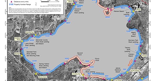
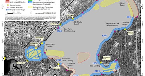
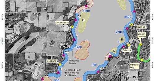
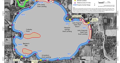
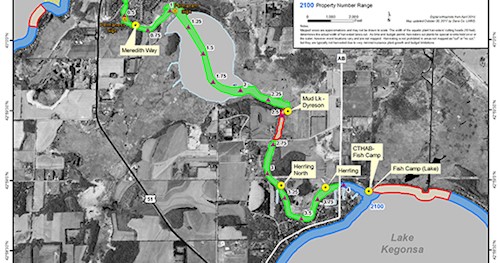
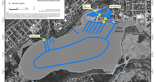
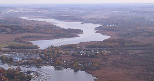
Aquatic plant management plans provide an inventory of existing plants in a lake or stream, and describe how native plants will be protected for their role as the foundation of healthy ecosystems, while nuisance non-native species will be controlled and recreational access will be provided. These plans are required by the Department of Natural Resources in order for them to permit aquatic plant harvesting programs under NR 109 Wis. Admin. Code and must be updated every five years. Some waterbodies also have a harvesting priority map (see below) that indicates potential cutting locations, as allowed by the permit.
Dane County staff and consultants surveyed aquatic plant communities during summer 2017 to learn how these plant communities have changed. They gathered data for each of approximately 7000 points on pre-determined sampling grids for the lakes being studied. At each point, they recorded information such as plant species present, water depth, sediment type, and fullness of the sampling rake. These survey results helped us assess lake health and update some of our plans.
Harvesting priority maps and plans are linked below. Visit our Harvesting Priorities webpage for a description of priorities.
2017 Map, Amendment, Appendices
2013 Amendment, Appendices
2007 Plan, Appendices
2017 Map, Amendment, Appendices
2013 Amendment, Appendices
2011 Plan and Appendices
2017 Map, Amendment, Appendices
2013 Amendment, Appendices
2011 Plan and Appendices
2017 Map, Amendment, Appendices
2013 Amendment, Appendices
2007 Plan, Appendices
2017 Map, Amendment, Appendices
2013 Amendment, Appendices
2007 Plan, Appendices
2017 Map, Amendment, Appendices
2013 Amendment, Appendices
2007 Plan, Appendices
2013 Amendment, Appendices
2007 Plan and Appendices
2013 Amendment, Appendices
2007 Plan, Appendices
2013 Amendment, Appendices
2007 Plan, Appendices
